
From the northern tip of
Sumba to Waingapu
This region is the driest and most sparsely populated corner of Sumba. After a
long dry period, everything looks dusty, brown and desolate. Sumba horses and Brahman
cows seek shadow from the scorching sun under the few trees. When you visit
this area from March after monsoon, the countryside is a lovely lime green.
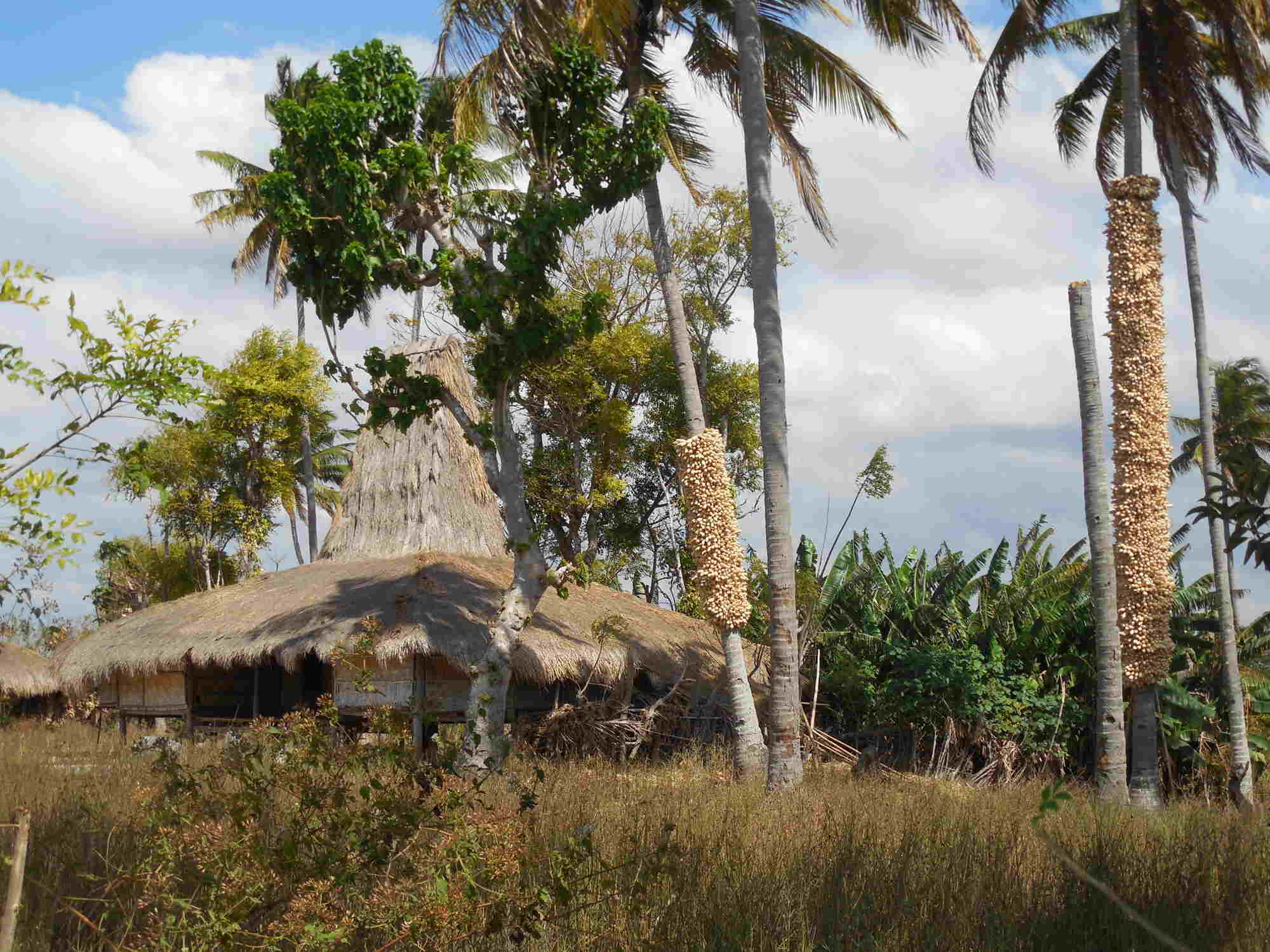
Tanjung Sasar, the northern tip of Sumba is uninhabited and barren; only on the mountain slopes some trees and shrubs grow. Wunga is the northernmost village and the oldest settlement in Sumba. It was set up sometime in the first millennium. For the people in Sumba Wunga is the source of their history – according to Marapu teaching ancestors of all Sumba people descended from this village. Either the ancestors came to this island by boat - or following Marapu belief by a ladder from heaven. It seems that time stands still there. Entries in the guestbook show that visitors come here only about once a month. Accordingly, you get received with friendliness by the villagers.
The road to the traditional village of Wunga does not start from the road sign Wunga but 7 km west of Kadahang at a bend and a quarry. Some buses from Waingapu, which go until Tana Mbanas can stop at the branch but most busses stop already before at Kadahang. From there it continues on an increasingly bad road, ending as a path below the village.
South of the main road is one of the largest jatropha oil crop cultivation areas with artificial irrigation, still under construction. It is accessible via the branch towards Prailangina. It is not worth the while visiting, because the planting looks quite bleak.
Kadahang (Lapau) is a small sleepy village at the most north-eastern river mouth. On the north side of the bridge, on the hill, where the paved road turns to the west, a small track branches off. It leads to a traditional fishing village and the beautiful beach Larodak (Larawali) and to the crocodile lake Laiwotung (Waimulang).Further south, but 2 km before the Kanatang River bridge a rugged track, branches off to the inland. After 13 km you reach the traditional settlement of Kalamba, which lies in a wonderful green riverine oasis. You can bath in the river. Swimming through the river, you can reach a small waterfall.
In the beautiful green Kanatang river plain lies the traditional village of Mondu. 500 meters south of the bridge, or 2 km northwest from Kambera beach, at a marketplace, a new road branches off inland. This road leads to the mountain village of Prailiang (Prainatang). After about 3 km you reach a point where you have a beautiful view over the river valley. The village is then opposite up on the hill. The mostly paved road then continues inland. First it leads over a desolate plateau, but then a beautifully green valley opens up. After 8 km you will reach the traditional village of Tanggedu. After two more kilometres the road ends at a suspension bridge. By motorcycle or on foot across the bridge and then on a trail you can reach the cataracts or the Air Terjun Tanggedu waterfall. It is hard to believe that there is so much water here, that it can form the rock. Many locals are there on weekends, it is better to go there during the week. South of Tanggedu the terrain is mountainous and there is no road or more recognizable trail. The Air Terjun Menggit (Tandula Jangga) Waterfall, located south of Tanggedu, can only be reached from the south via Ndapayami.
Continuing on
the coast road: After 200 meters, a path branches off to the north. Here is a
trail and view tower in the mangroves is planned. At the beach Kapihak a few simple beach bungalows might be built one day.
After 1 km you can turn inland to the traditional village of Padadita.
The villagers run farms,
keep cattle, and the
women are weaving. After another kilometre you will reach Kambera (Purukambera)
beach. You can stop off at Pantai Cemara Resort (if it is open). The fenced area to the east of
the beach is the base of a pearl farm.
Another inland road leads from Londalima Beach with a 5 km steep climb to the traditional part of the village of Kuta in the mountains. From there you have a beautiful view of the beaches at the coast and to Waingapu. Paths go through the inland and terminate at the road Waingapu Waikabubak.
In Temu, 1 km before the turnoff to the ASDP port, there is way inland to the waterfall Air Terjun Gunung Meja. The rocky track ends after about 5 km. On foot you must go along a water pipe down to the river and then through the river gorge. After 3 km you get to the waterfall, which pours into a beautiful turquoise pool. Hard to believe that in dry season there is so much water - in the monsoon season this way is not feasible.
You can explore the northern inland actually
only by motorcycle. Only a few small traditional villages lie in this savannah.
There are two ways through the savannah: A seldom used but good road goes
from Kadahang to
Soru. A second road from Rambangaru to Lewa is not paved, really bad and therefore normally avoided.
But you can use this road for trekking to the main road Waingapu – Waikabubak,
where you can get picked up.
There is no connection from Mondu via Tanggedu to Ndapayami. Corresponding signs on the main road Waingapu -
Waikabubak are incorrect. Reverse south-to-north routes mostly end when
settlement ends and the savannah begins.