
From Waitabula to the northern tip of Sumba
This area is similar to the northeast of Sumba and extremely dry. Just after
the monsoon, the landscape is lime green. Otherwise, only valleys and rivers
mouths are lush green like oases in a terra cotta coloured hilly area.
Unfortunately, in the dry season people partially burn the vegetation so that
the hills sometimes look black. In the river valleys bananas and rice are
grown, and corn in the semi-arid areas. The landscape hardly changes along the
north-western coast. Only on the hills many kilometres inland it becomes lush
green, and agricultural land begins again.
Between Lokory
in the west and Mamboro, the only major town in the area, are only a few
villages. 1 km behind the junction of the road from Waikabubak you get to the
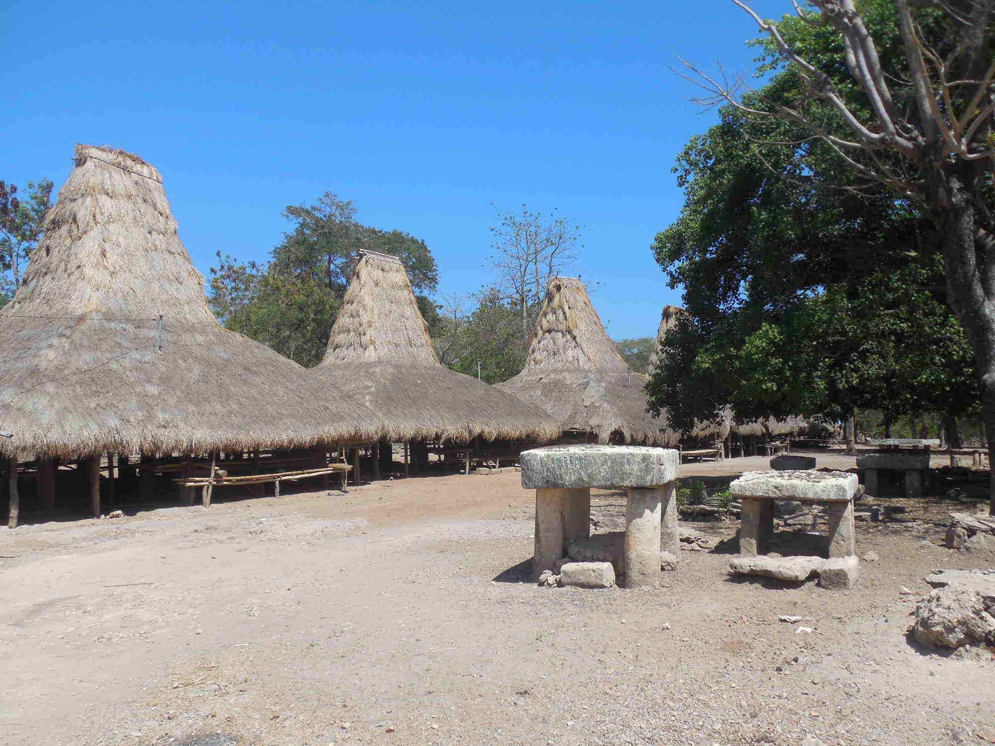
beautiful traditional village, Waiwarongu;
there you must turn towards the coast. All the houses are still covered with
Alang grass and there are many interesting tombs. Right of the village is a
small path that leads to the beach and the river estuary. You should not bathe
near the estuary because there might be crocodiles.
7 km further is Mamboro (Memboro). This place is divided into a Muslim district of immigrants and various traditional Christian or Marapu villages. The Muslims are mainly fishermen and live right at the beautiful 4 km long sandy and clean beach around the Kalada River mouth. The river can only be crossed on foot at the estuary, near the beach, and only during the daytime. At high tide and in the evening children bring you over the river with dugouts. The mangrove area opposite the city is reserved for monkeys and crocodiles. The outlying beach is safe.
The villages around are situated in the flood plain and on the mountains. From the traditional village Manua Kalada you have a magnificent view of the deep green river plain and surrounding mountains.
Between Mamboro and Kadahang there are only a few river valleys and estuaries, and only there are a few traditional settlements. Further inland there are some remote traditional villages in the valley cuts, which can be reached by stony paths. The people there live mainly from cattle breeding.
Along the road settlement projects sprung up a few decades ago. However many houses and some entire villages were abandoned. Partly only the concrete bases can be seen. There used to be a house about every 50 meters. Above all, those who have always lived there have remained. A few years ago, wild settlements of people cultivating seaweed have emerged on some parts of the coast. Not far away to it there are noble tourist projects under construction… .
Predominantly there are sandy sections at the coast. Beaches are not special but truly natural. There is only little vegetation, no shade, and no infrastructure. An exception is the bay and beach of Lenang (Pahar), half way between Mamboro and Kadahang.
The roads are throughout asphalted, although partly
narrow and in bad condition. Traveling by motorcycle you will need about 5 hours from
Tambolaka to Waingapu. The landscape is quite a nice alternative.
There
are few road connections inland. East of Mamboro you can hike via Manggewar to Sambaliloku in the increasingly green central highlands.
This is not recommended with a motorcycle.
The road from Waibakul to Mamboro is throughout in good shape. The road from Waikabubak to Mamboro varies from super to shitty. The road from Waikabubak to Lokory goes from Ekapata in a western bow through a very scenic area and is partially brand new. The remaining roads are mostly simple and go from village to village. Through trucks are rare on these roads.
At the end of Lenang bay shortly before the northern tip, the road turns inland and then goes eastward. You will see the traditional village of Wunga, the starting point of this description, 7 km off the east coast.