
Waingapu is a sprawling town. The oldest part of town is around the old harbour. There it is rather cosy. There are many small shops. In the evening fishermen sell their catch. 1 km further south is the new commercial center with market, gas station, hotels, and banks. Between the 2 parts and within the town area you can still find bicycle rickshaws. The town has only a few multi-storey buildings. Oversized administrative buildings with blue corrugated tin roofs and brightly painted sculptures are on the hill towards the south. At the eastern end of the hill is the PC Corner restaurant. From the upper floors you have a great view over the city ... and with a good view up to Flores which is 80 km north. At the central crossing next to a small park, a plastic palm decorated with exhausts shines at night in constantly changing colours. Muslims have settled around the mangrove shore. Christians and newcomers settle inland and along the irrigated river valleys. Often, they settle according to their former origin and often Ikat is produced there.
The old harbour and the mangroves shore are highlights for visitors.
When you leave the main roads, you immediately come to residential areas with
individual houses and gardens. Everywhere in between are small workshops and stores.
Half way between town and airport, to the inland, is the traditional royal
village of Prailiu. From
the originality it is unfortunately less worth seeing as other traditional
villages in the area. But women are weaving everywhere. You can look at the
manufacturing process, and maybe buy some woven fabrics.
From many hills within the
town area you have fantastic views - the colour changes from terracotta tones
to rich green areas - brightly decorated churches, flashing, domed mosques, and
the pointed roofs of corrugated tin protrude. From the hill opposite the entry
of the airport runway, you can look at the lagoon landscape. 500 meters south
of the airport building, it leads to the Table Mountain Persaudaraan
with great views of the city and the rice fields of Kambaniru / Mauliru plain.
Already the Japanese, who left bunkers and a flak platform there, recognized
the strategic view.
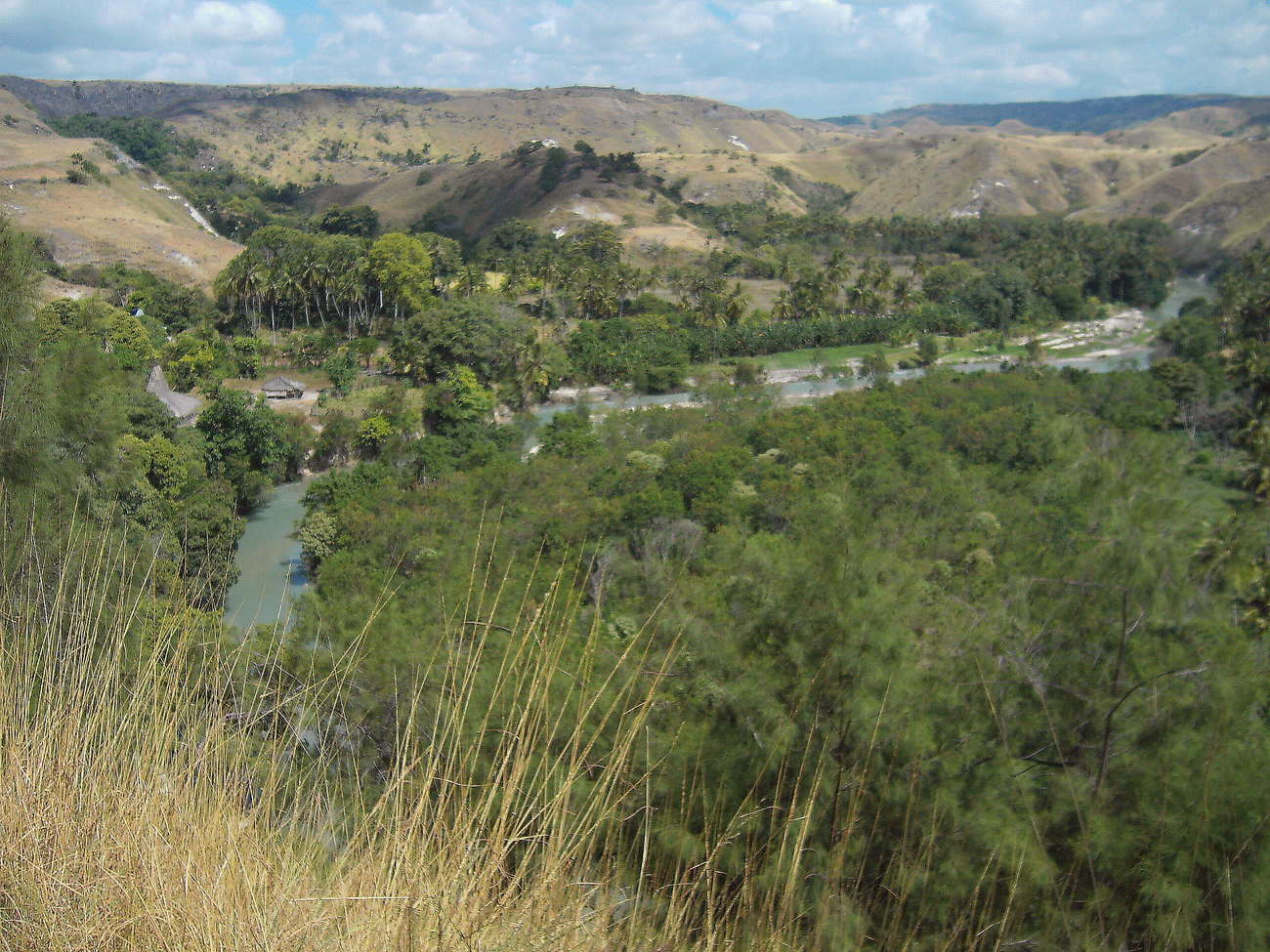
A nice half day trip is along the Kambaniru (Kambera) river inland. Behind the irrigated lowland you get to the Kambaniru (Lambanapu) dam. 1 km behind the dam is the Morinda resort on the top of a mountain. From there you can see the beautiful green river valley. Further on, past some traditional villages like Bibi Praing, the paved road ends at a river bridge. On the other side is the village Kiritana. You can hike up the prepared road further on behind the village and will have a great view. Everywhere is lush greenery of the valleys and irrigated fields with rugged limestone cliffs and round hills, which are green or brown depending on the season. Please keep away from the river, everywhere there are crocodiles of great size. There have been many accidents.
Other scenic
trips inland depart from the road to Waikabubak:
Right at the end of town, before the first climb, at a curve it branches south to
Mbata Kapidu. Passing
numerous small settlements in the deep green valleys, the road increasingly
gets worse and ends in unrecognizable trail in Luku Kamaru.
Behind the second Danau Pambotanjara (Danau Wairinding) lake, a road leads north. A sign points to Tanggedu Waterfall. That's definitely wrong, the way ends well before that, after about 17 km. The last third of this way is only accessible by motorcycle, perhaps not at all in the monsoon. After 4 km, a 1300 meters long climb made of concrete lanes branches off to Bukit Ndapayami. From the top of the mountain you have a great panoramic view of the untouched hilly landscape (much more beautiful than from Bukit Wairinding). A few simple paths lead from there towards Kuta and Londalima on the coast. The road to the north continues in the valley and ends just before the Air Terjun Menggit (Tandula Jangga) waterfall. The path down is well paved, but you should avoid some wooden junctions. This waterfall is on the same river as Tanggedu, but in my opinion is much more attractive.
Two kilometres further on you will pass the Bukit Wairinding viewpoint. It's nice, but many other trails north have similarly nice views. If you walk north on a path instead of the given route, there might be some nicer views…
A longer Inland Tour begins at the bridge before the airport and leads to Maidang. First you will go along the rice fields of the irrigated lowlands, then up to the mountains. From the top you have great views of the river canyon of the Kambaniru River. Half the way it is worth a detour to Maradamundi village. From the village there are a few paths down to the river ... but no bridge via that you could get back to Waingapu.
In Maidang there was a motorcycle suspension bridge over the Maidang River to the south. It was destroyed by Cyclone Seroja. To the west the street ends in the village center. Here the Maidang and Mandas join to form the Kambaniru River. In the dry season you can cross the Maidang River via a temporary footbridge, perhaps even by motorbike. On the other side of the river you come to Lumbung. There are only unexplored mountain hiking trails through the uninhabited highlands to the south. 15 km and 500 meters of elevation lie ahead of you before you reach the next road at Kukitalu. You can get to the Air Terjun Koalat waterfall by crossing the two rivers on foot right at the confluence. The lower and most beautiful stage of this waterfall is only about 300 meters behind. When the water level is high, the path is difficult, but the waterfall is more impressive. The residents of Maidang will be happy to help you find the way.East of Waingapu the water is shallow and there are many mangrove areas. In between, there are 2 nice and clean beach areas near the villages of Kawangu and Watumbaka. They are between 3 and 5 km past the end of the runway of the airport. The road is usually about 1 km from the coast, so you have to ask for the way. After about 14 km you come to the picture-postcard beach Walakiri. Best time to go there it is at low tide and/or in the evening. 1 km further, right hand behind a stone wall, it goes to a private ground called Pantai Li'ie. This is a beautiful place with 2 small beaches and a house with open sleeping floor. Shortly after it, is a branch to the Laipori Beach, Laki Beach and the 3-Leo Karaoke Resort. In terms of the beach, the area is not worth seeing. Here arise the first post-colonial villas.
At all beaches around Waingapu
you have to keep a safe distance to river mouths and mangrove areas there might
be crocodiles. Ask locals if the area is safe before venturing into the water!